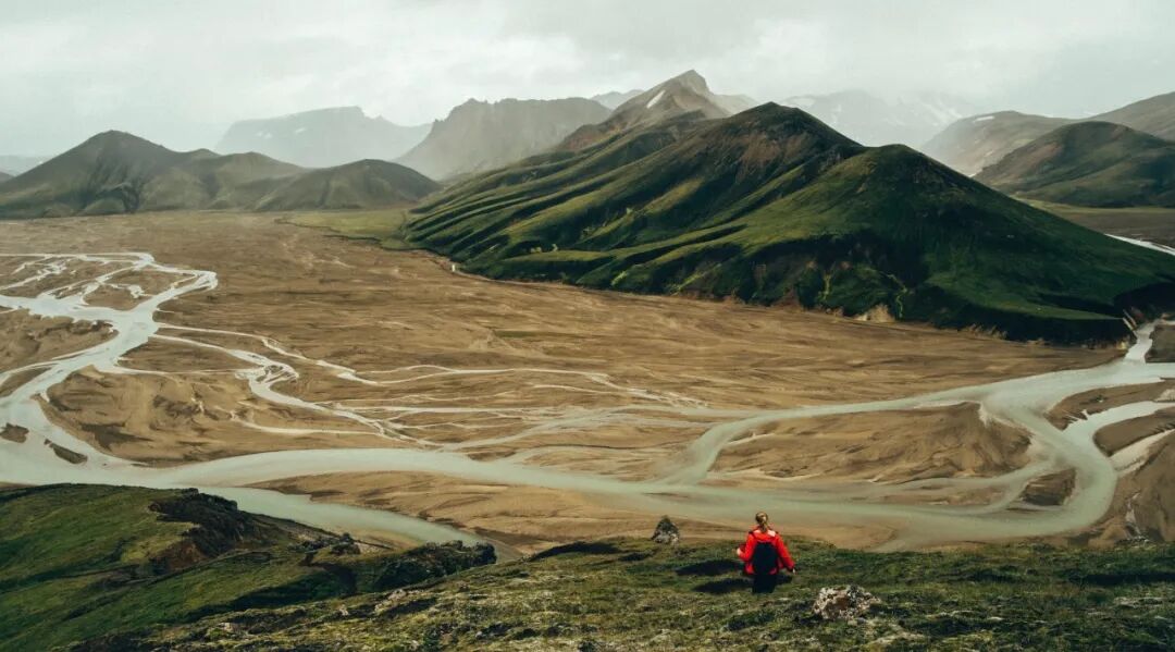
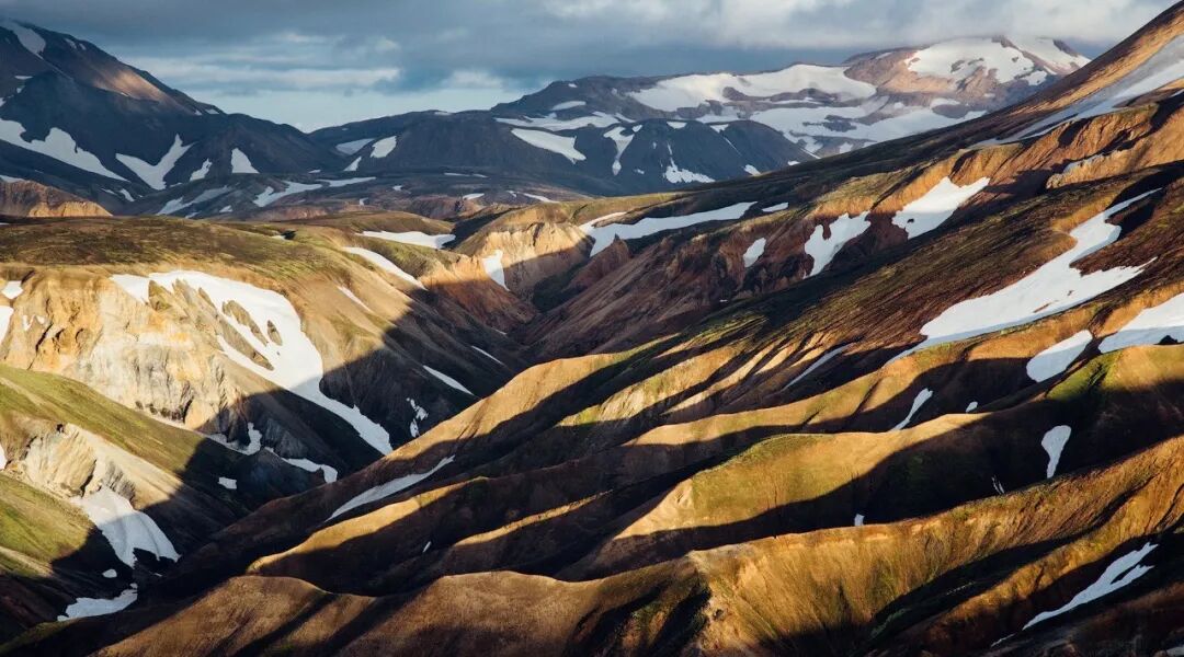
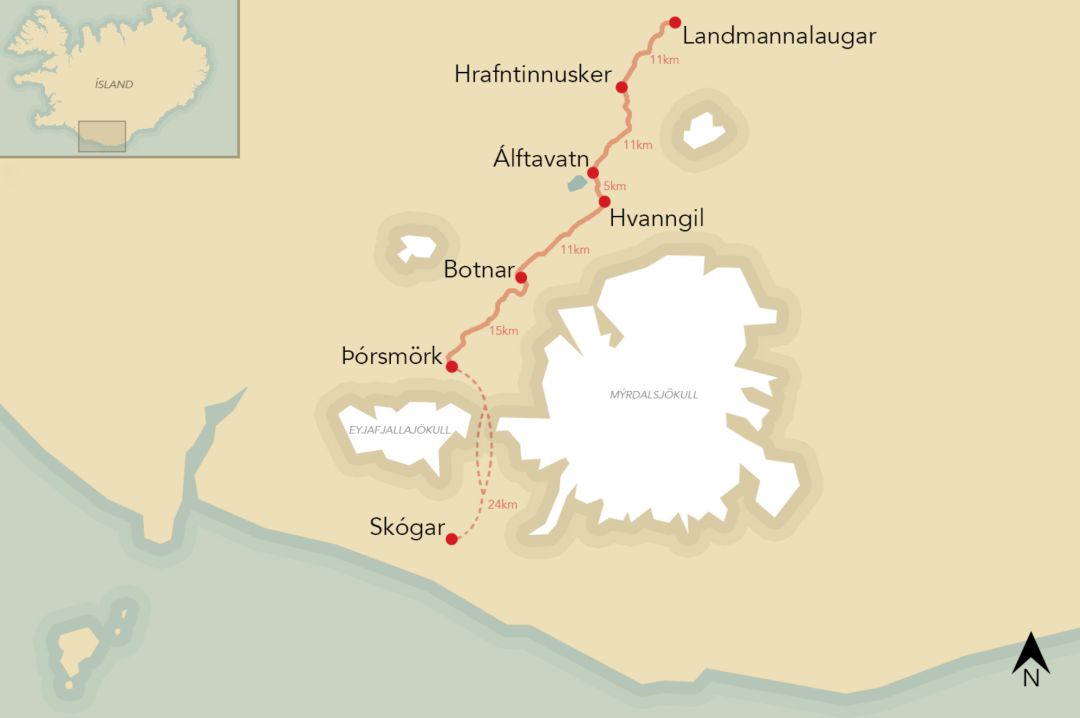
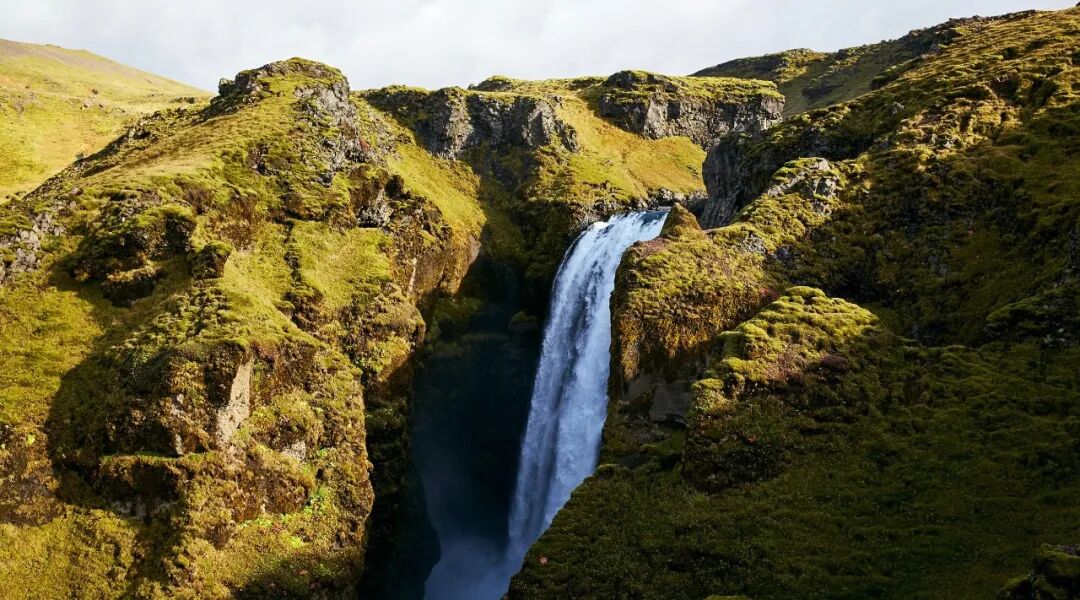
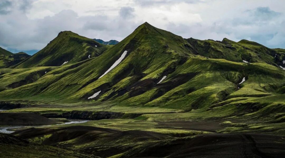
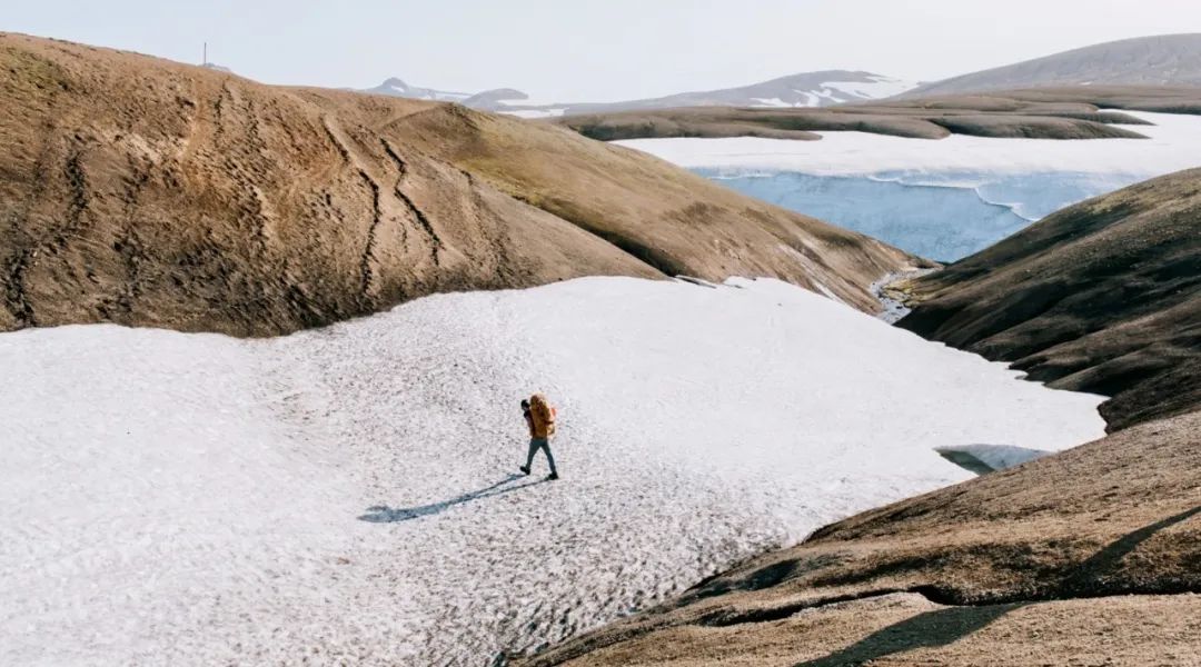
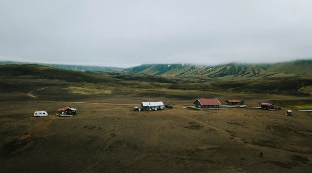
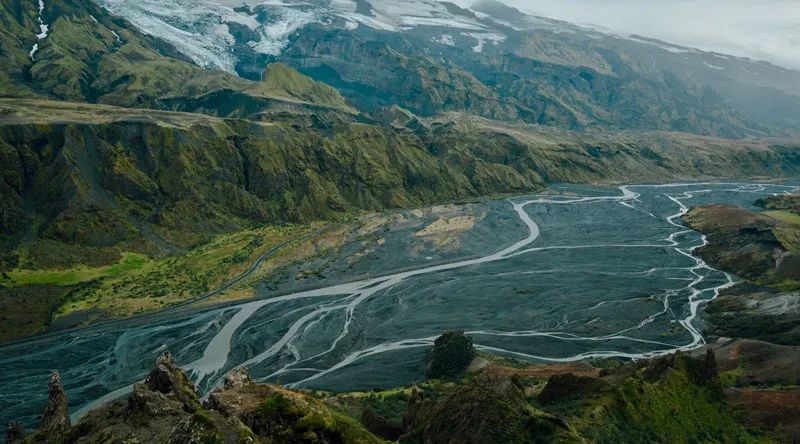
All the way south from Landmanalauka, through the hot geothermal area, through ice-covered canyons, rushing rivers and black deserts composed of volcanic ash, finally reaching the forest of Sosmok Valley, and then passing through 26 valley waterfalls, ending the journey in Skoga. You can stroll by the lake while hiking, Enjoy an outdoor barbecue and enjoy an evening at Read in the tent, and even find a hot spring to have a dip. For those who love the outdoors, this is probably the best way to experience the summer scenery of Iceland. The Inland Highlands are more alien worlds and fewer tourists than roundabout roads. Let me introduce this to you below Landmanna Lauka- Fimworohauers Classic hiking route that shows you the “wild” side of Iceland. 1. Line OVERVIEW Iceland’s inland highlands account for nearly half of the total land area, are uninhabited, and preserve the most primitive landforms. According to geography, it can be divided into three parts: north, central and south. Landmanna Lauka- Fimworohalls Trekking Trail Located in the southern highlands. Landmanna Lauka- Map of the Fimworohalls hiking route From north to south, from Landmannarauka to Sosmok Valley, these 54 kilometers are called Landmanna Lauka Trail ; Go on for another 24 kilometers To Skoga Falls, called Fimworohalls Trail 。 Connect these two sections together, which is 78 kilometers long Landmanna Lauka- Fimworohalls Route All the way to see the heat, canyons, glaciers, rivers, deserts, forests and waterfalls. 2. Travel plan Although the route is the same, the overnight spots arranged by different schemes will be slightly different, and the number of hiking days will also be different. We usually arrange 5 days and 4 nights: the first night is at Alftavatn Lakeside camping, 2 nd night at Botnar Camping, 3 rd and 4 th nights at Porsmork Camping, Day 5 at Skogar End. Of course, the specific arrangement can be flexibly adjusted according to your physical strength and holiday time. 3. Difficulty and distance Because everyone’s physical abilities are different, it is difficult to objectively define difficulty. But the good news is that we have logistics vehicles responsible for delivering food and camping gear, and hikers only need to carry small bags for the day. This is much easier than carrying your own weight all the way. ○ The average daily walk is 18 km, with the longest day being about 25 km ○ The average elevation is less than 600 meters above sea level. The maximum climb in a single day is about 800 meters ○ Primary luggage (food and camping equipment) is transported in advance by logistics vehicle ○ There are few artificial safety facilities along the route. For the less experienced, crossing glaciers (there may be ice cracks) and rivers (without bridges and road signs) is risky, but our guides will guide and help solve these problems throughout the journey. 4. Seasons and weather The suitable season for hiking is late June to mid September, with temperatures around 10 to 15 degrees. There may still be residual snow on the road, and the weather changes quickly, often with high winds and rain. 5. Food and housing conditions There are simple hikers’ huts along the way, which provide bunks (your own sleeping bags are required), public kitchens, bathrooms and a small supermarket, but they are often full in peak seasons. What we offer is tent camping, which is relatively more comfortable and private. There may be no hot bath for 2 of these nights. The logistics vehicle will transport camping equipment and ingredients to the camp in advance. Hikers need to set up tents by themselves and prepare dinner with the guide. There is a restaurant in the camp for 3 nights, and you can upgrade your meals for a fee, saving time and effort. Among them, 2 nights of the camp had no cell phone signal at all and could not be charged. Free WIFI is available at accommodations for the rest of the nights. 6. Special outdoor equipment Need to bring outdoor sandals and trekking poles. On the way, you will encounter downhill roads covered with volcanic ash, Trekking poles can help you keep your balance ; When crossing the river, you need to put on outdoor sandals, and trekking poles can also be used to detect the water depth.